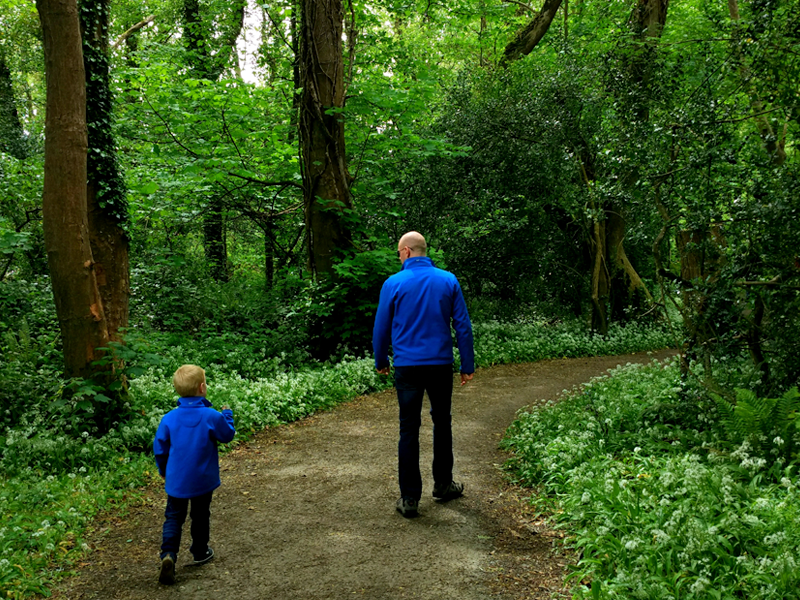
Walking in Tralee
Tralee has many walks in close proximity. From a leisurely walk along the Blenneville-Tralee canal, to wooded walks at Ballyseedy and Glenageenty Woods to the more advanced treks of the North Kerry and Dingle Ways. Something here for everyone.
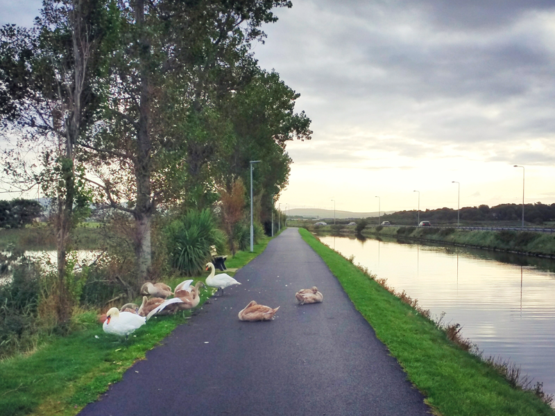
Canal Bank Walk: Picturesque walk along the old tow path of Tralee Ship Canal to Blennerville Village with the Slieve Mish mountains as the backdrop. Crossing the Canal Swing Bridge and Blennerville Road Bridge with fine views of Tralee Bay and the restored Windmill. Returning along Kearney’s Road with Tralee Bay Nature reserve on your left. A gradual rise to Healy’s Cross and return via the leafy suburb of Ballyyard Hill to Aqua Dome Car Park.
River Lee Nature Walk: This is a leisurely walk along the northern bank of the River Lee from which the town takes its name. It is a haven for wildlife including otter, heron and, beneath the water, salmon and trout. It extends on an elevated boardwalk as far as the ruins of the Geraldine Towerhouse at Castlemorris and as far as the Aqua Dome in the other direction. Our bridge is about half way along it. A nice extension of this walk is to cross the road at the Aqua Dome and walk around the lake at the wetlands centre.
Ballyseedy Woods: The woods dates back at least to the 16th centruy when it was first mapped for Sir Edward Denny. Further planting took place by Col. J Blennerhassett in the early 18th century who had his castle nearby. Today, Ballyseedy is a sustainable woodland recreational amenity for the people of Kerry and visitors alike. It is a unique and tranquil retreat which extends to nearly 80 acres. It has at least 22 varieties of native trees and they are marked with their Gaelic and English names in the woods. As you wander along the Old Coach Road which served the Blennerhassett estate and plantation, look out for the majestic Ash, Oak and Beech trees – they have been frowing here for centuries. There are a number of ruins and folllies within the wood, dating back to the 17th century, with the River Lee (from which Tralee takes its name) forming the woodlands northern boundary.
Glanageenty Walk: Glanageenty is an area of mistery, myth and folklore, a wild and rugged landscape that was once the sanctuary to some famous heroes and bandits alike. It starts behind O’Riardas Bar near Castleisland and is a good hike with spectacular views of the county.
The North Kerry Way: The North Kerry Way is a 48 kilometre linear walking route through the northern part of County Kerry, starting in the county town of Tralee and ending in the town of Ballyheigue.
While not as well known as the Iveragh or Dingle Peninsulas, North Kerry has much to offer, including spectacular seascapes, the finest beaches in Ireland and a multitude of ancient sites, churches and field monuments.
The route heads out of Tralee with the Dingle Way to Blennerville with its fine traditional windmill: there the routes part and the North Kerry Way heads north west along a sea wall at the back of Tralee Bay.
From the village of Spa it goes cross country onto the white sands of Banna Strand to reach the village of Ballyheigue and the beginning of a scenic mountainous area on Kerry Head, which it loops around before finishing at Ballyheigue.
The terrain consists of mainly quiet country roads, firm beach sand (except at high tide), tracks, bog roads and field paths. The route is flat except for the last 18 kilometres where there are some short ascents, with an aggregate climb of 370 metres.
There are some short loop walks which link with the main route of the North Kerry Way.
The Dingle Way: The Dingle peninsula, the northernmost of County Kerry’s peninsulas, stretches nearly 50 kilometres into the Atlantic, and is 21 kilometres wide at its broadest. It is a dramatic and varied landscape of coastal plains, sandy beaches, mountains and lakes.
The Dingle Way is a circular route beginning and ending in the town of Tralee that takes in all of these wonderments along the route. Leaving Tralee the route climbs onto the flanks of the Slieve Mish and contours westwards before crossing the peninsula to the scenic Inch beach on Dingle Bay. The route then meanders westwards by the villages of Anascaul and Lispole to the famed town of Dingle, where many walkers will want to stay a while and enjoy the good food, good music and craic.
West of Dingle is the most dramatic part of the Way, an exciting coastal trek around the westernmost point of Ireland and a return leg over a saddle below Kerry’s holy mountain, Brandon, and on to Tralee by the shore.
Terrain consists mainly of quiet tarmac roads, mountain, field and cliff paths, and over 20km of good beach walking. The aggregate ascent over the route is 2480m, and although there are some short steep ascents, there are no significant steep climbs.
The route is steeped in history and scattered with the ruins of ancient dwellings, forts, churches, and castles, and because of its circular layout, can be easily sampled in sections.
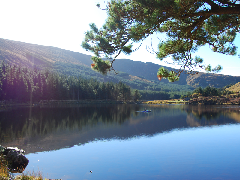
Glentanassig: This is a little hidden gem about 30mins outside Tralee. The unpaved road winds up through the forest where eventually you arrive at the lake. You can walk along the boardwalk around the lake. It’s ideal for kids as its good fun. You can park at the bottom and walk up to the lake if you are looking for a bigger challenge. See photo above of Glentanassig.
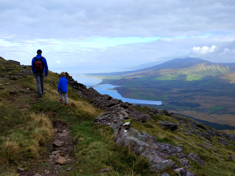
Mount Brandon: There are two ways to climb mount Brandon. The easy way and the hard way! Either way its an excellent mountain to climb with breath-taking views of Tralee Bay and the Atlantic from the top. The photo on the left was taken on the way back down Brandon.